Saturday, October 26, 2013

day 10: Castlegregory to Tralee

location: Castlegregory to Tralee
distance: 9.55 miles
entertainmentA Wise Man's Fear, watching parishioners leave Sunday Mass in Camp while waiting for the bus
sights: a monastery, lots of caravan parks, dogs and beach goers enjoying the weather and water
lodgingGreenview House B&B
dining: blood orange and blue sports drinks from the petrol station while waiting for the bus; underwhelming dinner in the front dining room of a once noble inn located in the high street of Tralee

route: after another day of less-scenic hiking past caravan parks, along busy roads and well-traveled side roads (as well as more beach), we opted to take advantage of the fortuitously-timed bus traveling through Camp back to Tralee, rather than spending an extra several hours covering track we'd already hiked, but in reverse. we spent our time waiting along side another backpacking couple (one of whom had an identical backpack to one of us) and watching Mass conclude at the Camp church and parishioners file out and head off to Sunday lunch.

the bus was nearly full when we boarded, with us taking the last two seats available -- one a few rows behind the diver and the other a few rows from the back of the bus. this day's adventure began as we arrived in Tralee. locals asked the driver to stop near the center of town so they wouldn't have to retrace the route back from the station. Andy, near the front of the bus, figured it would be a great opportunity to avoid extra hiking with packs, as the bus stopped about two blocks up from our B&B. sitting at the back of the bus, I didn't realize he'd gotten off the bus until I saw him standing on the side of the road with our packs as we pulled away -- waaaaay to late to rush to the front of the bus and have the driver stop for me to get off. instead, I went on my merry way to the station, hoping that Andy would either stay put or go someplace that he would know that I would know to look for him. and hoping that he'd grabbed both our bags out from under the bus after I got off and my bag wasn't waiting for me.

to be safe, I retraced the bus' route which skirted the (unnavigably) narrow streets of the center of town and took the longer walk back to where Andy got off. initially I thought he might try to follow the bus, but as we got farther and farther away, it seemed a preposterous idea. but all the same, I made my way past Debenhams, narrow townhouses and local businesses, the police station, the backside of a pub that also faced the narrow streets of the center of town and advertised live music every evening, and finally past where Andy got off to the B&B where we'd stayed at the start of our hike.


a much relieved Andy & I booked into our room, thanks to the proprietor's husband who was on duty at the time. got to enjoy the room on the first floor (one up from the ground floor), cleaned up and rested a bit before heading out in search of food. the food was fine enough, eaten in the front parlor/cafe of a high street hotel with impressive history, but not much to recommend itself today. would have been better off farther from the heart of town. even a block or two. but there were scoops of ice cream from a corner shop on the walk back to make up for any other failings. particularly in light of the bustle of Dublin the following day, Tralee was a pleasant reentry point from 10 days all but off the map.
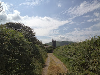
Thursday, October 24, 2013

day 9: Cloghane to Castlegregory

location: Cloghane to Castlegregory
distance: 11.79 miles
entertainment: A Wise Man's Fear
sights: gobs and gobs of beach with a smattering of holiday-makers, jellyfish stranded on the beach
lodging: Castle House B&B
dining: fried chicken, cheese sandwich, Lucozade and sweets from Spar; pizza from a family restaurant in the high street

route: not unlike day nine of our Camino, the road from Cloghane to Castlegregory was hot and unremarkable. except for the miles of sand we traversed along Cloghane Bay -- nothing like that in Spain. it started along narrow and disused country roads; disused because they only lead to Cloghane and out to the end of the peninsula beyond. most holidaymakers took the N over the pass into Dingle ... some of whom we encountered later in the day when we had to walk along a busier highway towards Castlegregory.

the beach was pleasant, though less novel after already spending so much time hiking along beaches on the southern portion of the hike. lots more jellyfish on this stretch, likely because of when we were walking in relation to the tide (around low tide, but coming in, based on the class of surfers attempting to catch the baby waves coming in). poked one of the beached ones -- very dense and wholly un-jelly-like as I recorded it.

we passed a churchyard wherein stood a memorial to a ship lost in Brandon Bay after traveling from "lower California." only a few bodies were recovered from the sea, most of which were interred in a tiny church cemetery we happened across on the way to Castlegregory.

rather than hike the "extra" several miles out to the end of the peninsula, we opted to cut straight across and got to Castlegregory quite early in the day, comparatively. our bags, however, had not yet arrived, so after eating our picnic lunch from Spar on the patio of our B&B (which was really just the parking area forecourt) we spent a good while recovering on the quite comfortable double bed upstairs waiting for them to arrive so we could change out of our slimy clothes.

almost as soon as we set foot in Castlegregory, we could tell we'd reentered holiday-making civilization. the Tralee-Dingle road runs close enough to the town to make it worth stopping off and its proximity to one of the largest beaches in Ireland means that the town was fairly crawling with weekend merrymakers. the parking lot of the Spar was jammed at lunchtime, but empty when we walked past later looking for dinner. lots of people in swim gear and sandals; caravans; a pharmacy and corner shop dedicated primarily to beach-related concerns.

after dinner we stopped into a pub near our B&B (where we'd unsuccessfully solicited some dinner) and had a pleasant pint on a pine bar before Saving Private Ryan started up on the television set behind the bar. an consequence of airing whatever was on RTE or TG4 totally at odds with the increasingly boisterous Saturday night revelers. we headed out before the dance party got going, glad for a nice quiet room with the promise of tasty, generous breakfast to set us off in the morning.

Tuesday, October 22, 2013

day 8: Feohanagh to Cloghane

location: Feohanagh to Cloghane
distance: 12.2 miles?
entertainment: a terrier pup following us through its farm, watching the Three Sisters recede and disappear behind the saddle of Mount Brandon, A Wise Man's Fear
sights: Smerwick Bay behind, Cloghane Bay ahead; turf cutting; art gallery offering the most welcome cold refreshment of our lives
lodging: Mount Brandon Hostel
dining: sack lunches packed for us by An Riasc (tasty), and dinner at the pub next door

route: our morning started out with a fabulous breakfast, negotiations to have both our packs transported, and two sack lunches to be enjoyed at some point on our hike. we were off a bit later than normal and the day promised to be a toasty and challenging one, packs or no.

we wended our way through a few more farms, encountering a herd of sheep moving along a track from one pasture to another, and later an extremely friendly spaniel puppy followed us from one edge of its territory to the other before getting a bit concerned about its distance from mom and turned around. shortly thereafter, we passed through a farm gate and began our ascent along an old, green track up the side of Mount Brandon.

it was a challenging uphill climb, even without our packs, and more than a bit toasty in the bright sunlight. lots of breaks and convincing ourselves to get to a particular spot just a bit farther up the hill, with a water break at that sign post, or a sit just the other side of that gate. saw a fair number of sheep off to either side getting the tastiest bits of grass and generally steering clear of us humans. we rested for a bit at the top of the pass, enjoying the spectacular views towards Cloghane Bay. our guide referenced a standing stone with ogham cross carved into it, which was easy to spot, standing right in the way.

the downhill climb proved a whole new measure of challenge -- the loss of all the elevation we gained going up in about a quarter of the distance and soggy patches determined to catch and turn an ankle. we'd met a German woman in the hostel in Dunquin who climbed Mount Brandon in that direction -- straight up the steep face first and then nice and easy down the other side. can't imagine doing it that way, but I wouldn't be surprised if she had the same reaction when hiking the opposite direction we went from Dunquin to Dingle.

heading down put paid to the notion that everything would be easier on the descent. we walked past a clump of apprehensive cattle, an old guy cutting turf, and finally an art gallery advertising cold drinks. without our packs, we were carrying less water than normal and had run out about half way down the back of Mount Brandon -- with kilometers and kilometers left to go. sitting in the shade of the gallery wall, drinking cold Coke with a straw, it was some of the tastiest beverage you've ever enjoyed.

reinvigorated with sugar and caffeine, we opted to cut off an optional 8 extra kilometers and head straight for Cloghane, rather than the end of the Brandon peninsula. though our bags had preceded us to the hostel, the room wasn't prepped, so we headed to the pub next door for some much needed hydration and lunch of our tasty B&B sack lunch. we returned later, after showering and washing clothes, to one of the tastier meals for dinner and another fantastic evening of off-the-beaten-path-holiday atmosphere.